IntelEspace
About us
 Created in 2009 at the Maison des Sciences de l’Homme (MSH) of Clermont-Ferrand, the main mission of IntelEspace is to support laboratories hosted by the MSH in the field of geomatics. Its investment specifically concerns physical and environmental geography and archeology, but it also has strong interactions with geology and agriculture in the context of research projects. It also offers its services to external partners, particularly local authorities and more occasionally to consultancy firms specializing in environmental data acquisition. It is composed of three Geomatics Engineers oriented geoenvironment and archeology and is permanently reinforced by engineers and post-doctorates with long-term contracts in connection with research or service delivery activities.
Our services
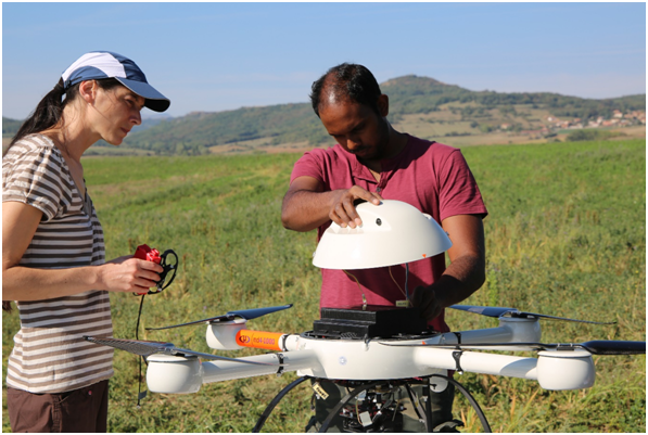
Multisensor drone data acquisition: multispectral, thermal, LiDAR, and post-processing of these data.
Technologies / Equipments
- Md4-1000 quadcopter drone equipped with a LiDAR Sick (+ - 6 cm accuracy), a multispectral camera (Micasense RedEdge), and a thermal camera (Flir Vue Pro R640).
- Main processing software: Geographic information systems and image processing (ArcGis, Qgis, Erdas, Agisoft PhotoScan, Pix4D).
Some of our achievements
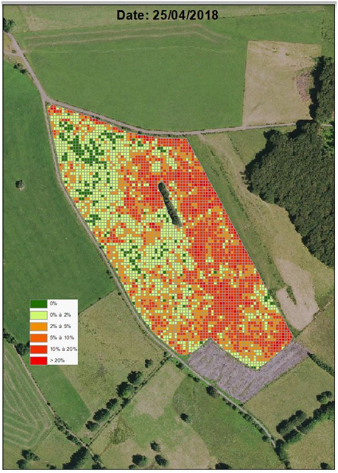
- Agriculture: Detection of voles indices in pasture meadows using a multispectral camera (INRA plot tracking)
- Archeology:
- Detection of remains on agricultural plots by thermal and multispectral camera;
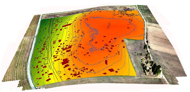
- Topographic Atlas of the Gergovie site from a LiDAR data set.
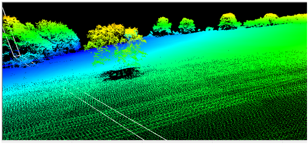
- Geoenvironment: monitoring the evolution of alluvial vegetation by LiDAR and historical stereoscopic photogrammetry.
Contacts
Scientific leaders
Tel.: +33(0)4 73 34 68 06
Tel.: +33(0)4 73 34 68 57
Secretariat
Tel.: +33(0)4 73 34 68 00
Address
Intelespace, Maison des sciences de l'Homme
4, rue Ledru, Clermont-Ferrand CEDEX1, France
4, rue Ledru, Clermont-Ferrand CEDEX1, France